Amtrak stations mapped by ridership

Amtrak Unlimited Discussion Forum

Help Support Amtrak Unlimited Discussion Forum:

This site may earn a commission from merchant affiliate links, including eBay, Amazon, and others.
Status
Not open for further replies.
Joined
Mar 31, 2011
Messages
5
Map of riders by station:

8438870763_81337199ec_o.png


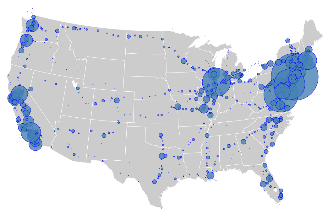
http://www.flickr.com/photos/mulad/8438870763/

Was posted on the Greater Greater Washington Site.

http://greatergreaterwashington.org/

TW
 
Last edited by a moderator:
Some of those dots are odd...I can make out the International's route (CHI-Port Huron-Sarina-Toronto), but there seem to be a lot more in southern Ontario than just that and the Maple Leaf. When was the last Detroit-Toronto or Detroit-Buffalo train pulled?
 
What would be even more interesting would be to see what these dots would be like if the ridership was divided by the population of the area contributing to the station. I suspect that the sizes would change dramatically.
 
Some of those dots are odd...I can make out the International's route (CHI-Port Huron-Sarina-Toronto), but there seem to be a lot more in southern Ontario than just that and the Maple Leaf. When was the last Detroit-Toronto or Detroit-Buffalo train pulled?
I don't know specifically about southern Ontario, but I know some of these dots represent Thruway bus stops. There are four tiny dots right around the area I live that have never had Amtrak service but have thruway service. And many other dots in the surrounding area are along Thruway routes.
 
Last edited by a moderator:
I made the map. I noted in the description page on Flickr that it's a work-in-progress and many of the stray dots are either Thruway Bus stops, defunct stations (some are there from the Sunset Limited and even the Pioneer), or even random bus stops that are no longer part of the Thruway network (they may or may not be Greyhound, etc.)

I had originally been working with GPS coordinates from http://www.ensingers.com/Bill222E/gpsamtrak.html and I've been busy mixing in ridership data, updating coordinates, and filtering out the detritus. I plan to post another map in a few days.
 
Can someone explain to me why there are two different blue dots in Central Ohio on this map. There are no Amtrak sanctioned Thruway bus stops or stations in this area.

Edit...Already answered by the previous post, since Columbus and Zanesville are both from the list of GPS coordinates! :hi:
 
Last edited by a moderator:
There seem to be some from the Gulf Breeze as well, and...was there a Nashville link at one point to the Kentucky Colonel?

Anyhow, many thanks for the map, and I look forward to seeing it develop (and, hopefully, seeing iterations over time).
 
There seem to be some from the Gulf Breeze as well, and...was there a Nashville link at one point to the Kentucky Colonel?
Anyhow, many thanks for the map, and I look forward to seeing it develop (and, hopefully, seeing iterations over time).
If you're thinking of the Kentucky Cardinal, then no, that never ran south of Louisville. (At the start of its service, it actually didn't cross the Ohio and ended in Jeffersonville.....) If I recall correctly, though, there is Thruway bus service to Nashville.
 
I made the map. I noted in the description page on Flickr that it's a work-in-progress and many of the stray dots are either Thruway Bus stops, defunct stations (some are there from the Sunset Limited and even the Pioneer), or even random bus stops that are no longer part of the Thruway network (they may or may not be Greyhound, etc.)
I had originally been working with GPS coordinates from http://www.ensingers.com/Bill222E/gpsamtrak.html and I've been busy mixing in ridership data, updating coordinates, and filtering out the detritus. I plan to post another map in a few days.
Neat map. What station boarding/alighting data are you using and from what time-frame? Shouldn't the map show just the FY2012 station passenger counts for an up to date picture of Amtrak?
 
There seem to be some from the Gulf Breeze as well, and...was there a Nashville link at one point to the Kentucky Colonel?
Anyhow, many thanks for the map, and I look forward to seeing it develop (and, hopefully, seeing iterations over time).
If you're thinking of the Kentucky Cardinal, then no, that never ran south of Louisville. (At the start of its service, it actually didn't cross the Ohio and ended in Jeffersonville.....) If I recall correctly, though, there is Thruway bus service to Nashville.
I didn't realize there was such a service. With that said, yes, I know it was the Kentucky Cardinal...but it was such a mess of a train that I felt it needed some fun poked at it. And I know it never ran past Louisville, but I didn't know if there had been any Thruway attached to the end of it.
 
Very intriguing map; well done. It really says something when Alton, IL has more ridership than Omaha. The impact of number of runs and their timing are made more obvious. The CHI-STL corridor has five daily trains each direction, mostly daytime, while Topeka and Lawrence are overnight stops on one LD train daily.
 
Most of the boarding/alighting data is FY2012 -- I've been using the ridership numbers from station entries on Wikipedia, which are fairly accurate but there might be a transcription error here or there. Amtrak doesn't typically publish ridership information for Canadian stations, but I think Montreal and one other station did have FY2011 numbers published on greatamericanstations.com. California station ridership is a mix of FY2010, FY2011, and FY2012 data, which I think is simply because Amtrak California (a Caltrans division) publishes data at a different time. I'll try to track down consistent FY2012 data for California at some point, though.
 
Most of the boarding/alighting data is FY2012 -- I've been using the ridership numbers from station entries on Wikipedia, which are fairly accurate but there might be a transcription error here or there.
I think it would be easier to pull the station passenger numbers from the state fact sheets which have been updated for FY12 than to get them from wikipedia. The Great American Stations website has "state" entries for Vancouver in British Columbia and Montreal in Quebec with passenger counts. The Maple Leaf is operated by VIA north of Niagara Falls so the passenger counts for the Maple Leaf stations in Canada is not provided by Amtrak.

What might be interesting if station passenger counts for earlier years, say FY2002 and FY2007, were located so graphical charts for 5 year intervals could be generated. I think by FY2017 we will see substantial growth in CA, the Cascades, CHI-STL, CHI-DET, Virginia, NC corridors, providing more balance to the distribution of station passenger counts. NARP's website may have historical ridership and station data.
 
Yeah, the state fact sheets are what Wikipedia generally uses -- the good thing about the Wikipedia articles is that you can navigate forward/backward along individual routes pretty easily with links in the infoboxes on right hand side of each page. I had started by doing all of the Empire Builder stations, then the Cascades and Coast Starlight, and continuing circling around the country.

Thanks for the tip about the Maple Leaf being run by VIA. If anyone knows if VIA has ridership broken down by station as well, that'd be interesting to add to this map, but it'll probably be pretty quiet for much of Canada since they have even worse service frequencies in many cases.

Yeah, I'll probably try to get in touch with someone from NARP about older data. It's pretty frustrating that Amtrak typically only keeps documents up on their website for about 12-18 months.
 
I made the map. I noted in the description page on Flickr that it's a work-in-progress and many of the stray dots are either Thruway Bus stops, defunct stations (some are there from the Sunset Limited and even the Pioneer), or even random bus stops that are no longer part of the Thruway network (they may or may not be Greyhound, etc.)
I had originally been working with GPS coordinates from http://www.ensingers.com/Bill222E/gpsamtrak.html and I've been busy mixing in ridership data, updating coordinates, and filtering out the detritus. I plan to post another map in a few days.
Hello....I really like your map as an example of data visualization. I was wondering whether you'd give me permission to use it in a class that I teach. I'd be happy to request this from you in an email, but can't find a direct email addy to use.

Thanks,

Stitcher.
 
Stitcher,

if you join Amtrak unlimited (AU) as a member(it's free), then you can send a Private Message (PM) to mulad (and other AU members too). Guests are not allowed to send PM's to members, and I would not recommend posting an email on a public forum.
 
Stitcher,
if you join Amtrak unlimited (AU) as a member(it's free), then you can send a Private Message (PM) to mulad (and other AU members too). Guests are not allowed to send PM's to members, and I would not recommend posting an email on a public forum.
Thanks....did it.

Yeah...I wouldn't post my email publicly....just needed a point in the right direction for making contact. Thanks for the help.
 
I'm intrigued by the rather large dot over Southern Maine. I know the Downeaster is pretty popular, but it appears that dot is nearly the same size as a bunch of ones in California. Is this saying that Southern Maine receives roughly the same Amtrak ridership as some of those California routes?
 
I'm intrigued by the rather large dot over Southern Maine. I know the Downeaster is pretty popular, but it appears that dot is nearly the same size as a bunch of ones in California. Is this saying that Southern Maine receives roughly the same Amtrak ridership as some of those California routes?
Portland ME had 214 thousand passengers in FY2012, in the same range as Hanford CA (210K), San Jose (234K), San Juan Capistrano (244K). There are 5 daily Downeasters to Portland, so it is a good example of the benefits of more than once a day service frequency.
 
Some small dots are explainable as connecting bus service sold by Amtrak.

In terms of high population but small dot size, I suspect Houston wins the dubious distinction.
 
Status
Not open for further replies.
Back
Top