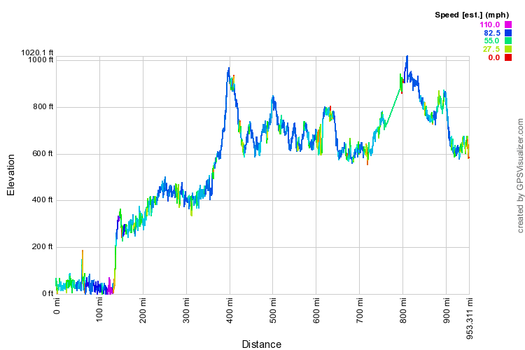
Union Pacific posts a map of high and low elevations. On it if you follow the Sunset Limited route the high elevation is 5,078 feet at Paisano TX. It also goes through the lowest elevation on the US railroad system, 205 feet below sea level at Forrum CA along the Salton Sea.
Extremes in advertising are not new. The "low altitude route" advertisement for the Golden State Route was a little extreme. The high point on that route was 6,726 feet at Corona NM, which was only about 1,000 feet or so lower than the high point on the AT&SF's Super Chief route. However, if you really want high, the route is the CZ route. We have all the "mile high city" noise about Denver, but it is NOT in the mountains, It is on the plain at the foot of the mountain. The high point on the railroad is at Moffat tunnel, 9,239 feet on the UPRR map.


")