KmH
Engineer
The Sunset Limited/Texas Eagle mashup leaves LA after dark (10 PM), so there's not much to see until daybreak.
May 4, 2017 I'll be on the SL/TE between Maricopa (MRC) and Alpine (ALP).
This will be my first time on this train route, though i have driven I-8 and I-10 numerous times. I’ve looked at YouTube videos and Google Maps too.
On May 4 sunrise is at about 5:38 AM and the train is scheduled to reach MRC at 6:30 AM.
Sunset will happen about an hour before the train reaches Alpine, if it's on time.
I'm putting together a shot/video clip list for that day.
If you know of anything I might want to add that I don’t mention, chime in.
I used to live in Tucson so I know there is little of interest west of Maricopa. Gila Bend doesn't count, but I probably won't be up and about until we get to MRC anyway.
I'll make stills, a video clip, or both when we go through Casa Grande.
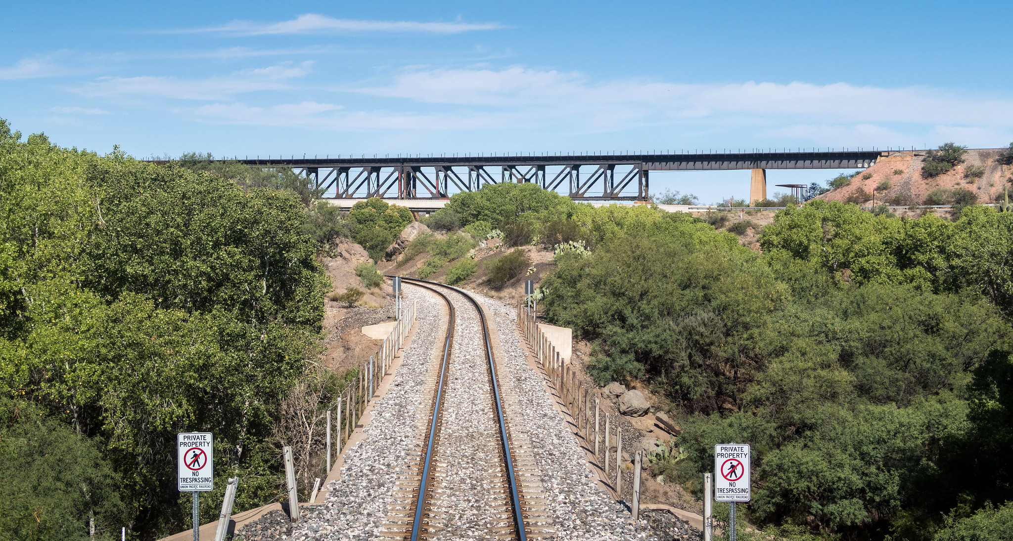
I'll get video out the railfan window of going under I-10 soon after leaving Casa Grande.
(Is the last car on the 2/422 a coach, or a sleeper?)
Next I'll get stills/video of Pichaco Peak.
We’ll running right next to I-10 after Eloy so I might get some video/stills of traffic on I-10.
I'll get video of pulling into Tucson.
Since Tucson is a service/refueling stop I’ll get off the train and shoot some video and stills while were there.
I am thinking about trying to shoot the Port of Tucson's, 2.5 mile, double loop Inter-modal train car facility.
https://www.google.com/maps/@32.1242866,-110.8331142,1856m/data=!3m1!1e3
I’ll try to catch were the 2 tracks split just after Houghton road since they don’t join up again for about 20 miles. If we luck out and are on the north tracks we’ll get some nice scenery as we go along Pantano Wash and Cienega Creek. There is a nice 180°, 1500 foot wide switchback after Davidson Canyon, but tracks don’t come back together until just north of Mescal.
I’ll get some shots/video as we negotiate Benson and we start climbing out of Benson heading for Dragoon Pass and the Dragoon Mountains Benson so there are some nice curves that should make some nice video. The Dragoon Mountains is where Cochise was able to evade capture for several years - Cochise Stronghold.
On the other side of Dragoon Pass and after the little town of Cochise the tracks go for 3 miles across a dry lake bed before we go through Wilcox.
After Wilcox I hope I can get some shots of the Large Binocular Telescope on Mt Graham in the Pinaleno Mountains. The sun should have the side of the dome facing the train lit nice and bright if it’s not cloudy.
Six miles or so into New Mexico there’s another dry lake bed the train and I-10 cross for about 6 miles.
We stop briefly in Lordsburg and Deming.
After that it’s routine high desert until about ½ way between Akela and Santa Teresa when we rail by the Arden Lava Flow.
https://www.google.com/maps/@32.0522132,-107.0066548,14292m/data=!3m1!1e3
UP has a nice new inter-modal yard just outside Santa Teresa that’s worth some shots.
https://www.google.com/maps/@31.9087564,-106.7423022,4133m/data=!3m1!1e3
Then after Sunland Park I’ll be able to get some shots/video of Mexico as the train gets as close to it as it gets.
Soon after that we’ll be entering El Paso and I should be able to get some shots of UTEP before we get to the El Paso station. Out of El Paso we join up with I-10 again about 10 miles southeast of Tornillo.
At Sierra Blanca we veer away from I-10 and head southeast to join up with US-90 some 7.5 miles south of Van Horn. At that point we are 90 miles from Alpine. It’s worth noting that this 90 mile segment has a 40 mile dead straight section of track I'll probably shoot some video of out the railfan window..
May 4, 2017 I'll be on the SL/TE between Maricopa (MRC) and Alpine (ALP).
This will be my first time on this train route, though i have driven I-8 and I-10 numerous times. I’ve looked at YouTube videos and Google Maps too.
On May 4 sunrise is at about 5:38 AM and the train is scheduled to reach MRC at 6:30 AM.
Sunset will happen about an hour before the train reaches Alpine, if it's on time.
I'm putting together a shot/video clip list for that day.
If you know of anything I might want to add that I don’t mention, chime in.
I used to live in Tucson so I know there is little of interest west of Maricopa. Gila Bend doesn't count, but I probably won't be up and about until we get to MRC anyway.
I'll make stills, a video clip, or both when we go through Casa Grande.
I'll get video out the railfan window of going under I-10 soon after leaving Casa Grande.
(Is the last car on the 2/422 a coach, or a sleeper?)
Next I'll get stills/video of Pichaco Peak.
We’ll running right next to I-10 after Eloy so I might get some video/stills of traffic on I-10.
I'll get video of pulling into Tucson.
Since Tucson is a service/refueling stop I’ll get off the train and shoot some video and stills while were there.
I am thinking about trying to shoot the Port of Tucson's, 2.5 mile, double loop Inter-modal train car facility.
https://www.google.com/maps/@32.1242866,-110.8331142,1856m/data=!3m1!1e3
I’ll try to catch were the 2 tracks split just after Houghton road since they don’t join up again for about 20 miles. If we luck out and are on the north tracks we’ll get some nice scenery as we go along Pantano Wash and Cienega Creek. There is a nice 180°, 1500 foot wide switchback after Davidson Canyon, but tracks don’t come back together until just north of Mescal.
I’ll get some shots/video as we negotiate Benson and we start climbing out of Benson heading for Dragoon Pass and the Dragoon Mountains Benson so there are some nice curves that should make some nice video. The Dragoon Mountains is where Cochise was able to evade capture for several years - Cochise Stronghold.
On the other side of Dragoon Pass and after the little town of Cochise the tracks go for 3 miles across a dry lake bed before we go through Wilcox.
After Wilcox I hope I can get some shots of the Large Binocular Telescope on Mt Graham in the Pinaleno Mountains. The sun should have the side of the dome facing the train lit nice and bright if it’s not cloudy.
Six miles or so into New Mexico there’s another dry lake bed the train and I-10 cross for about 6 miles.
We stop briefly in Lordsburg and Deming.
After that it’s routine high desert until about ½ way between Akela and Santa Teresa when we rail by the Arden Lava Flow.
https://www.google.com/maps/@32.0522132,-107.0066548,14292m/data=!3m1!1e3
UP has a nice new inter-modal yard just outside Santa Teresa that’s worth some shots.
https://www.google.com/maps/@31.9087564,-106.7423022,4133m/data=!3m1!1e3
Then after Sunland Park I’ll be able to get some shots/video of Mexico as the train gets as close to it as it gets.
Soon after that we’ll be entering El Paso and I should be able to get some shots of UTEP before we get to the El Paso station. Out of El Paso we join up with I-10 again about 10 miles southeast of Tornillo.
At Sierra Blanca we veer away from I-10 and head southeast to join up with US-90 some 7.5 miles south of Van Horn. At that point we are 90 miles from Alpine. It’s worth noting that this 90 mile segment has a 40 mile dead straight section of track I'll probably shoot some video of out the railfan window..