


NS VIA Fan
Conductor
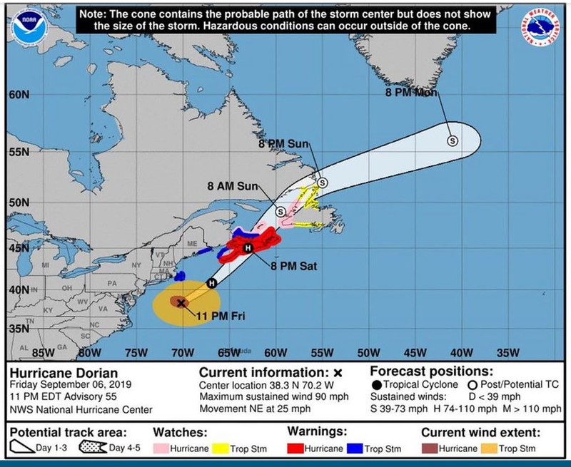
We’re under a Hurricane Warning now and it looks like Dorian will make a direct hit over Halifax around 8pm this evening.
Last evening VIA delayed the departure of the eastbound Ocean from Montreal by 24 hours. It would have been arriving in Halifax this afternoon just as the storm was ramping up.
“Due to potential severe weather conditions affecting the Maritimes the following will apply: Train 14 of September 06 which is scheduled to depart Montreal at 19:00 ET will depart 24 hours later on Sept 07.”
Consequently, the westbound Ocean due to depart Halifax on Sunday is also delayed by 24 hrs.
“Due to potential severe weather conditions affecting the Maritimes the following will apply: Train 15 of September 08 which is scheduled to depart Halifax at 13:00 AT will depart 24 hours later on Sept 09.”
One particular area of concern with the storm surges is the isthmus that connects New Brunswick to Nova Scotia. This is a low diked area with the CN mainline and Trans Canada Highway just above sea level. It's the only way by land into or out of Nova Scotia.
") Nothing new there.
Nothing new there.